


Why A Road Here?
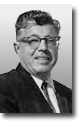
John Rico
The younger generations, as they travel our super freeways from north to south, east to west, perhaps give little thought for some of the reasons roads were constructed in the locations in which they are now.
Of local interest is the highway which now bisects the city of Vacaville, and connects the metropolitan Bay Area to Sacramento and points east. Had not it been for the pioneers of yesteryear, the freeway may have been built on another line, rather than meandering through Vacaville, and on its way to the bay.
The most important trail in northern California at the time of the man on horseback was known as the Old Pena Pass Road, connecting Sutter’s Fort to Sonoma Mission, and going via Vacaville, down through Lagoon Valley, through the low hills further south, and then across to Sonoma, saving the rider the task of going directly through the Blue Mountains to the west of Vacaville.
And just why did these riders select such a route? Certainly it was not the shortest, but it provided the one essential needed for survival of man and horse—water. Lagoon Lake, south of Vacaville, provided water, and throughout the years a path was carved to the lake by riders going from the gold fields of the Mother Lode area, on their way to the bay. As time passed, buggies and wagons used the roads, then came the automobile and an almost identical trail was used for the “gas buggy.” The advent of the automobile as a means of transportation brought on the necessity for better roads, so engineers started to take some of the curves out of the old horse trail.. This proved good enough for a few years, but high-powered engines in automobiles brought on speed, and speed necessitated roads without curves.
In areas south of Vacaville can still be seen the remnants of the old Lincoln or Highway 40 as it meandered along creeks and property lines in a snake-like fashion.
We have reproduced a famous landmark in our Yesteryear series of pictures showing the famed Vaca Valley bridge over Alamo Creek. This bridge, and its overhead arch with the words Vaca Valley, was a famous sight for travelers on that highway many years ago. An enlargement of the photo is on the wall at the Coffee Tree at Vacaville.
Before the days of the automobile, horse drawn stages made the run from Sacramento to Vallejo, and in the winter months the drivers sought to avoid as much flood waters as possible, so headed their teams for the high ground along the hills of Vacaville. The lands east of Vacaville were flooded during the winter months.
History does not record all of the notables who traveled this Old Pena Road, but there were many. We do know that there is mention of a young lieutenant named William Sherman who traveled the road, stopped at the Vaca adobe in Lagoon Valley, and then continued on to the gold fields at Coloma. It was the same Sherman who became a general and rose to prominence in the Civil War.
Then there was Edwin Markham, who resided in Lagoon Valley, and traveled the road to and from school. He later became famous as a poet, and wrote his “Man With A Hoe.”
When the Mexicans ruled the state they used the old Pena road to go north to gather Army horses, and to keep an eye on Americans who were entering California without permission.
The rider and his horse in search of a suitable trail must be given credit for establishing the route for today’s freeway from Sacramento to San Francisco. Railroad engineers were not enthused by the location of these trails because they wanted the shortest route between two points, and surmounting obstacles which seemed impossible, built their railroads on a straight line. The railroad made possible the town of Elmira, and it took many years for promoters to build spur lines to serve Vacaville.
Old-timers will tell that Vacaville had the horse and buggy road, but Elmira had the railroad.
About
 This is an archive of "Around Vacaville" written by John Rico for the Vacaville Reporter Newspaper. Mr. Rico was the Publisher of the Reporter from 1935 to 1973.
His love for his community continued throughout the years as he chronicled Vacaville's history in his personal weekly column, "Around Vacaville".
Mr. Rico passed away in October of 2001.
